Mae Ping National Park in the Regional Landscape of Northern Thailand
A measured guide to northern forests, river landscapes, biodiversity, and thoughtful travel planning
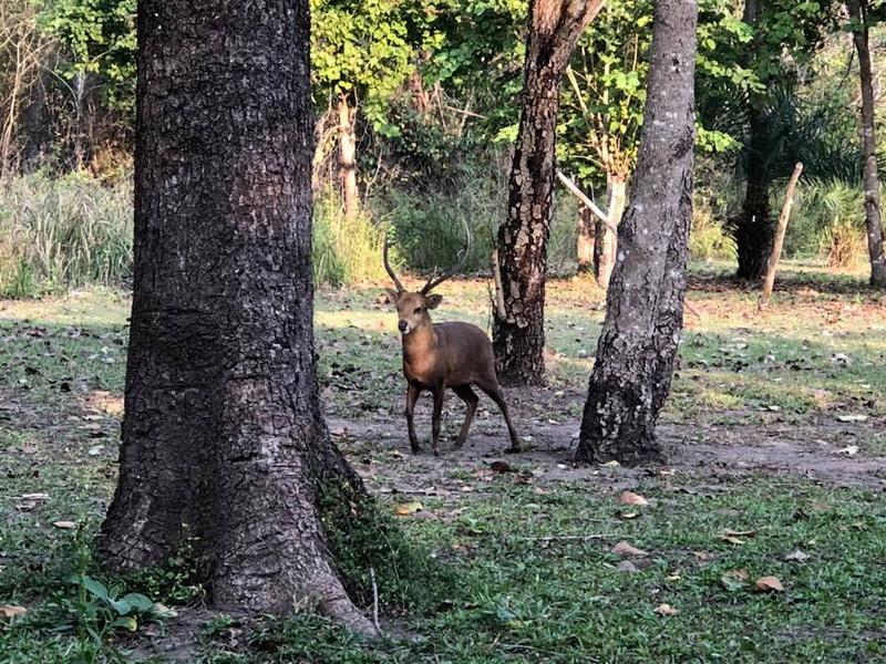
Northern Thailand is often described through its mountains, but its protected landscapes are more varied than a single highland image suggests. National parks extend across evergreen forests, mixed deciduous woodland, limestone formations, river valleys, reservoirs, and seasonal waterfalls. Together, they form an important environmental network in the upper part of the country and offer different ways to understand the region beyond its urban centers. Mae Ping National Park provides a useful regional case study. Located in Li District, Lamphun, and extending across a broad landscape associated with the Ping River basin, it has a character distinct from the more elevated parks near Chiang Mai. Forest habitats, rocky features, waterways, and open seasonal scenery shape the visitor experience. This Mae Ping National Park Travel Guide places the park among the wider National Parks in the North of Thailand while keeping the emphasis on natural features, regional context, and practical considerations rather than promotional claims.
A varied network of protected landscapes
The phrase Top National Parks In The North Of Thailand can refer to several different kinds of destination. Doi Inthanon National Park is known for Thailand’s highest mountain and cool highland environments. Doi Suthep–Pui lies close to Chiang Mai and combines forested slopes with important watershed areas. Huai Nam Dang is associated with mountain scenery and broad viewpoints, while Sri Lanna protects forests and waterways in the Chiang Mai region. These parks differ in elevation, accessibility, climate, and the type of landscape visitors encounter.
Further east and north, Doi Luang, Doi Wiang Pha, Khun Chae, Chae Son, Mae Takhrai, and Doi Phu Kha demonstrate the range of northern protected areas. Some are dominated by ridges and upland forest; others include caves, hot springs, waterfalls, or river headwaters. Ob Luang is especially associated with a dramatic river gorge and archaeological surroundings, while Mae Yom and Wiang Kosai include substantial forest landscapes in the central-northern part of the country. This variety means that comparing parks only by scenery can be misleading. Their ecological roles and seasonal patterns are equally significant.
Northern parks also contribute to watershed protection. Forested slopes slow rainfall runoff, support streams, and provide habitat corridors for wildlife. In drier months, deciduous forests may appear open and brown, while the rainy season brings denser foliage and fuller waterways. Smoke and haze can affect parts of the north during the dry season, although conditions vary by place and year. A regional view therefore helps visitors set realistic expectations: a national park is not a single, unchanging scene, but a living landscape shaped by weather, elevation, and conservation management.
Mae Ping National Park and its river-basin setting
Mae Ping National Park is situated in Li District, Lamphun, in a landscape connected with the Ping River and the forested interior of northern Thailand. Its setting distinguishes it from parks whose main appeal is a very high summit. Here, the relationship between woodland, river valleys, rocky terrain, and open water is central to understanding the park. The name is sometimes written as Maeping National Park, while travel references may also use Mae Ping National Park Lamphun or Mae Ping National Park Li to clarify the location.
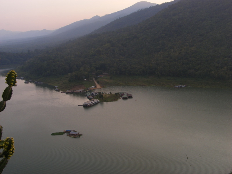
The park’s terrain includes mixed forest environments rather than one uniform vegetation type. Deciduous woodland can look relatively open during the dry season, allowing views through the trees, while wetter periods encourage greener growth and more active streams. Evergreen elements occur in suitable areas, particularly where moisture and elevation create different local conditions. This variation supports birds, small mammals, reptiles, insects, and plant life adapted to seasonal change. Wildlife sightings should be treated as uncertain and incidental rather than expected attractions.
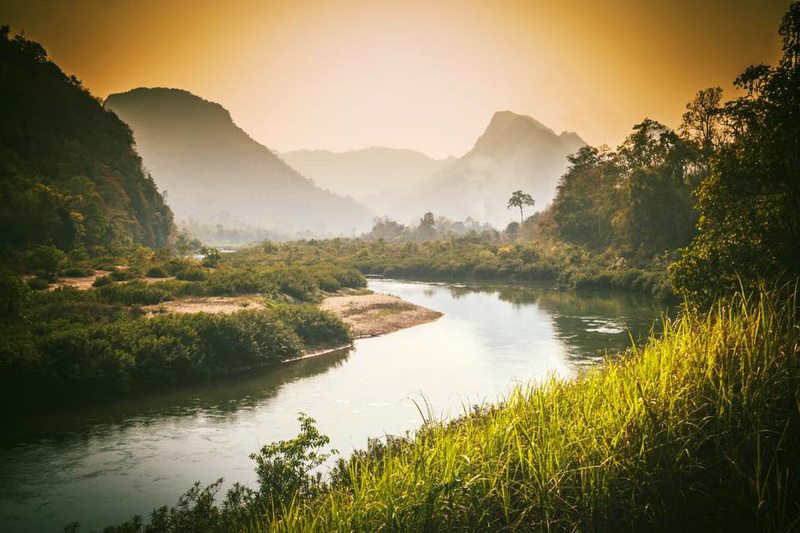
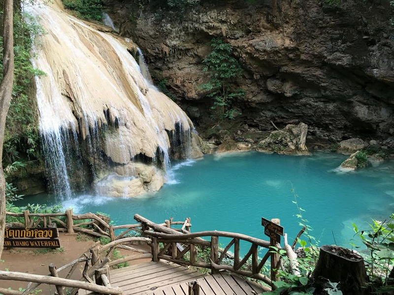
Water is an important part of the park’s visual and ecological identity. The Ping River and associated waterways help explain the area’s geography, while reservoirs and river-edge spaces create contrasting views within the broader forest landscape. Ko Luang Waterfall is one of the features commonly associated with Mae Ping, with limestone surroundings adding a geological dimension to the park. Water levels and the appearance of cascades can change considerably according to rainfall, so descriptions of the landscape should always be understood in seasonal context.
Why the park is notable in regional comparison
Mae Ping stands out because it brings together several landscape experiences without relying on a single iconic viewpoint. A visitor may encounter forest roads or paths, river scenery, exposed rock, waterfall country, and broad waterside views within the same protected area. The result is a quieter, more varied sense of place than the image of a conventional mountain park might suggest. Its appeal is particularly understandable for travelers interested in how rivers and forests shape northern geography.
The park is also useful for observing the effects of seasonality. In the rainy season, vegetation is generally more vigorous and streams may carry greater flow. After the rains, some routes and natural features can appear more accessible visually, while the dry season may emphasize open woodland and muted colors. Temperature and weather can differ between low-lying river areas and higher forested ground. These changes are not merely aesthetic; they influence fire risk, water availability, animal activity, and the condition of unpaved surfaces.
In the context of Mae Ping National Park Thailand, conservation is inseparable from visitor behavior. Forests in northern Thailand face pressures that can include wildfire, agricultural expansion beyond protected boundaries, litter, and disturbance of wildlife. Visitors can reduce their impact by staying on appropriate routes, carrying waste out when facilities are limited, avoiding loud behavior near streams or forest edges, and never feeding animals. Fires should be treated with particular caution, since a small careless flame can have consequences far beyond one picnic site.
Planning a visit without oversimplifying the journey
Mae Ping National Park is not best understood as an automatic day excursion from every northern destination. Its location in Lamphun’s Li District places it within a broader rural region, and journey times depend on the starting point, road conditions, weather, and the particular area of the park a traveler hopes to see. A map review is useful before departure, especially because protected areas can cover substantial distances and different entrances or facilities may serve different purposes.
Travelers beginning in Chiang Mai may encounter the phrase Chiang Mai Vacation Package in general planning materials, but that wording should not be taken as evidence that a particular itinerary includes Mae Ping or that access arrangements are guaranteed. The sensible approach is to confirm current park information, local conditions, opening arrangements, route suitability, and transport needs through authoritative sources before setting out. This is especially important when the intended visit involves waterfalls, forest roads, or areas affected by seasonal weather.
A visit can be planned around landscape observation rather than a checklist of attractions. Allow time to notice changes in vegetation, river color, rock formations, and signs of human management. Early preparation should include drinking water, sun protection, suitable footwear, basic first-aid supplies, and layers appropriate to changing temperatures. Mobile coverage and services may be inconsistent in rural or forested areas, so travelers should avoid relying entirely on a phone for navigation or emergency communication.
The park may suit independent travelers who are comfortable with a slower pace and some uncertainty in natural conditions. It can also be meaningful for families or older visitors if the selected route matches mobility, heat tolerance, and available facilities. Not every viewpoint or trail is suitable for every traveler, and a national park’s natural setting should not be treated like a managed urban attraction. Checking terrain and weather in advance helps prevent an enjoyable landscape from becoming an unnecessarily difficult outing.
Reading Mae Ping as part of Northern Thailand
One of the benefits of visiting parks across northern Thailand is the opportunity to compare ecological settings rather than searching for one definitive landscape. Doi Inthanon illustrates high-elevation environments, Ob Luang emphasizes a powerful gorge, and Doi Phu Kha presents a different mountain and forest context. Mae Ping contributes river-basin scenery, seasonal woodland, limestone features, and a more spacious lowland-to-foothill character. Each park adds a different chapter to the regional environmental story.
That comparison also encourages a more respectful understanding of protected areas. Parks are not simply backdrops for photographs; they are habitats, watersheds, research settings, and places connected to surrounding communities. Travel should therefore remain attentive to local rules and to the possibility that some areas may be closed or restricted for safety or conservation reasons. Avoiding unauthorized collection of plants, stones, or other natural materials is a basic part of responsible visitation.
For readers researching Mae Ping Forest Park or similar terms, it is worth checking that search results refer to Mae Ping National Park rather than another forest recreation area with a related name. Clear location information prevents confusion, particularly because northern Thailand contains many parks and protected landscapes with overlapping geographical references. The most reliable planning decisions come from current official information, local guidance, and an honest assessment of personal ability.
Why This Place Stays With You
Mae Ping National Park is notable not because it represents every northern landscape, but because it reveals one important part of the region: forests shaped by seasonal weather, waterways, river valleys, and varied terrain. Considered alongside the mountain parks and forest reserves of Northern Thailand, it offers a grounded perspective on the area’s ecological diversity. Visitors who prepare carefully, observe without demanding certainty from nature, and respect conservation rules can approach the park as more than a scenic stop. It becomes a way to understand how land, water, climate, and communities intersect across Lamphun and the wider north.

No comments:
Post a Comment